Wednesday, March 29, 2017

Behind Moonshine Falls

Here’s another waterfall to add to your Upstate waterfall bucket list! Moonshine Falls is a 40 foot cascade that was once the site of a moonshine still, the evidence of which is still on scene today. The other unique feature of this Greenville county waterfall is that the trail takes you behind the falls, a rather exclusive adventure here in the Upstate.


There are four different ways of reaching Moonshine Falls, none of them under 5 miles and all of them rated moderate to strenuous on the Mountain Bridge Wilderness Area trail scale. The most difficult route is probably from the Raven Cliff Falls parking area, as it includes 2.1 miles on the Raven Cliff Falls trail, 1.5 miles on the Dismal Trail, 1.2 miles on Naturaland Trust Trail and a little over ½ mile to the falls for a total of 5.3+miles – and that’s one way! You can also park at the Caesars Head Visitor Center and take the Frank Coggins Trail to Naturaland Trust Trail and come in from the east. A third option is jumping on Pinnacle Pass trail (which originates at the Jones Gap Learning Center) where it crosses US 276 and tying in with Naturaland for a one-way hike of about 2.8 miles (also from the east) – be warned it is mostly uphill on your way out. All of these routes feature significant elevation change, and although I don’t shy away from a challenge, there were two factors that played a role in selecting the fourth option: Mikus and Vilis. (For detailed trail instructions and elevation profiles for all four routes, visit Brenda J. Wiley’s blog here.)

easy to see where the red tailed hawk gets its name

An out and back from Asbury Camp might be the easiest route to reach the falls, but it does originate on private property, crossing into the Mountain Bridge Wilderness Area after a short stretch on Naturaland Trust Trail. I had been putting this hike off as the degree of technical difficulty and remoteness aren’t conducive to hiking alone with two kids, but the perfect opportunity came when the Pacolet Area Conservancy (PAC) announced their spring hike series. Not only would we have permission to enter through Asbury Camp, but we would also have company on what is around a 6-mile hike.

this eastern tiger swallowtail was caught by the late frost

From downtown Greenville it’s about 45 minutes to Asbury Drive in Cleveland, SC. If you reach Bald Rock, turn around and head back down 276 about a mile to Asbury Drive. Asbury welcomes hikers to use their trails, as long as camp is not in session; call ahead of time to check the schedule and to request permission – (864) 836-3711. Having turned west, follow Asbury Drive all the way north until it ends; this is the trailhead.

Follow the signs for Asbury Trail past the impoundment

Starting up the gravel road you’ll soon reach the impoundment for a tributary of Matthews Creek, the small lake providing swimming and boating for Asbury campers. Follow the trail into the woods, where you’ll start your climb on a wide trail blazed red – this is the main Asbury Trail and you’ll want to take care to stay on it. There are half a dozen other trails that split off to various other attractions, and it’s easy enough to get sidetracked if you’re busy paying attention to other things such as spring blooms or your children!

Largeflower heartleaf - hexastylis shuttleworthii

One such turnoff is marked “Cascade Falls,” and although we were hiking with the group and didn’t visit the waterfall on this hike, I’m told it’s only 500 feet to reach the small cascade that has an excellent swimming hole. Someday we’ll also explore the “Asbury Falls” turnoff, however on this particular day we stayed on Asbury Trail for another tenth of a mile or so to reach Matthews Creek and the cable bridge.

Photo courtesy of PAC

A couple miles upstream the creek tumbles 400 feet from Raven Cliff Mountain, while downstream Matthews Creek flows into the South Saluda near Saluda Hill Baptist Church. Here at the crossing, the creek is swift and rocky. Mikus wasn’t tall enough to attempt the cable crossing alone, but with a little help was able to rock-hop across the creek. Vilis rode in the backpack carrier for the crossing, but in another year getting to the other side might pose a problem; we’ll have to bring water shoes and wade across. A few members of our group crawled across on a downed tree, but to most the cable posed no problem. Remember, it just looks intimidating, however be prepared!


After crossing the cable bridge the trail soon intersects with Naturaland Trust Trail (blazed pink), where we turned east and started climbing in elevation again. The ascent didn’t last long, as in about ½ mile we reached the turnoff to Moonshine Falls. The trail to Moonshine is marked by a rock cairn, and although it’s not otherwise signed or blazed, you’ll know you’re on the right track when you see an old wooden kiosk a hundred feet down the trail. At one point the shelf housed a hikers log, but these days visitors walk right by. From the cairn continue on for another ½ mile to the top of a small rise. Here you’ll want to take the well-worn trail that descends down to the left, and soon you’ll find yourself in the cave behind Moonshine Falls.


The rocks behind the waterfall provide the perfect lunch spot, or a point to further explore the falls from. Following a little goat path down to the right (before the cave) will take you to the base of the falls where you’ll want to take off the shoes and wade around in search of the perfect angle for your shot of the falls. Meanwhile in the cave you’ll find the detritus of the moonshine days, rusty old barrels heaped in a pile. The boys explored while I photographed, and once everyone was rested up had finished their lunch, we took a group shot before heading back up towards Naturaland Trail.


If you still have the energy, just 0.2 miles downstream is another waterfall, Confusion Falls. The name probably refers to the two separate currents; they are actually from two separate creeks which come together at this precise spot to form the falls, and just a short distance later it all empties into Matthews Creek. For directions to Confusion Falls and another small cascade, click here.
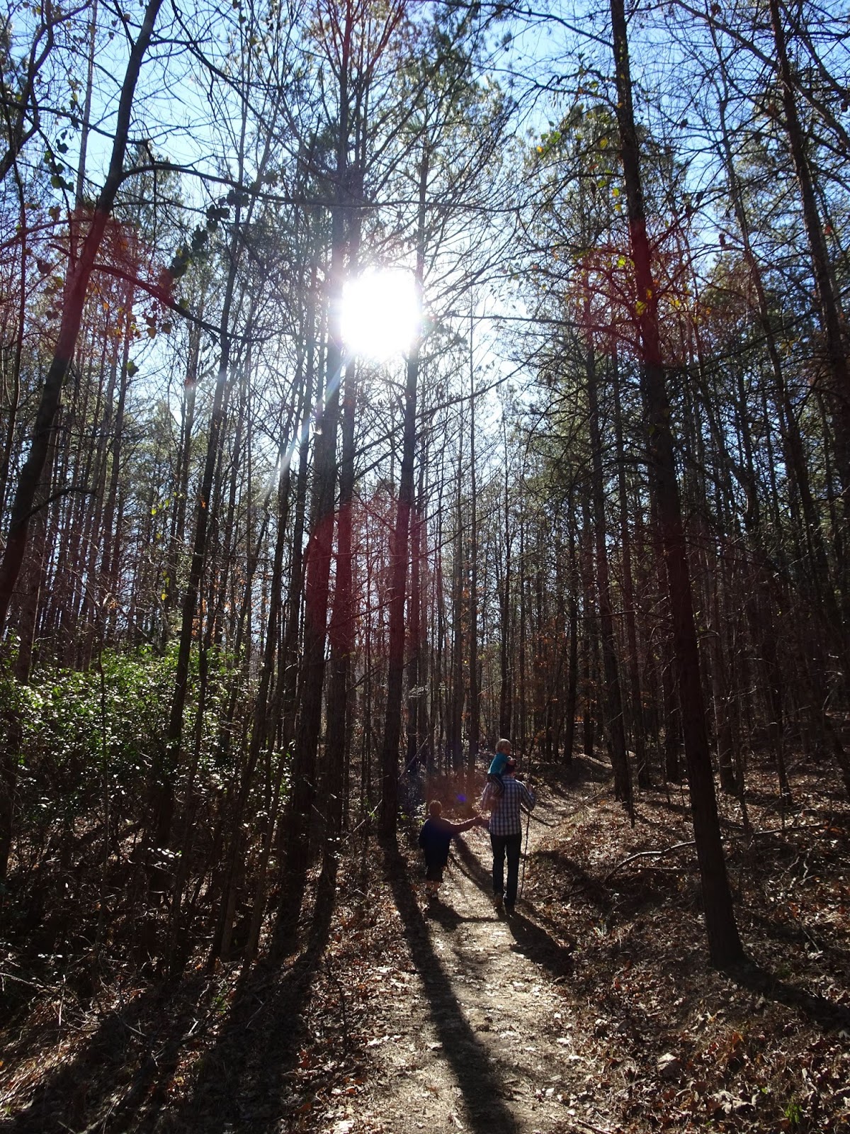


Other than the initial ascent from the cave and the cable crossing, the route back is pretty much a walk in the woods. We kept our eyes peeled for animals & interesting plants and were rewarded with a sighting of a red tailed hawk in addition to many beautiful wildflowers. Mikus enjoyed learning the names of the ferns and flowers, and Vilis was able to alternate riding in the backpack with walking. There are still spring hikes left on the PAC schedule, including this Friday on the Pisgah and next Friday on the Palmetto Trail; for a full schedule visit the PAC website.


Monday, March 27, 2017

Your guide to the Swamp Rabbit Trail

If the creation of Falls Park was the spark that set Greenville on track to become a beloved hometown and vacation destination to thousands, then it’s the GHS Swamp Rabbit Trail that has become the locomotive still pulling us forward today!


About the trail...

The old Carolina, Knoxville and Western Railway line was nicknamed for the large cottontail rabbit that roamed these parts back in the day, and although the tracks have been replaced by a paved trail (and locomotives by runners, walkers and cyclists), the name stuck. The 19.9-mile trail stretches from Travelers Rest to downtown Greenville, with additional sections in Lake Conestee Nature Preserve and Fountain Inn. There is yet another extension slated for construction starting next January that will connect Cleveland Park and the Verdae development off the Motor Mile, and long-range plans have discussed bringing the trail all the way to Cedar Falls Park. It could be that in the future the entire length of the Reedy River will be covered, and residents would have a multi-use trail connecting the Upstate to the Saluda River!


The north end of the trail

The trail starts in Travelers Rest (often referred to as “TR”), the gateway to the Blue Ridge Mountains. What used to be a sleepy mountain town was transformed with the advent of the Trail into a hub for outdoor adventure. Today, TR is a destination in itself, not just a stop on the way to Caesars Head and Table Rock.

The Swamp Rabbit Trail has become so intertwined with the legend of Greenville that dozens of local businesses have jumped on the train; for example in Travelers Rest you will find the Swamp Rabbit Brewery & Taproom, Swamp Rabbit Inn, Swamp Rabbit Storage and Swamp Rabbit Tees. For ideas on what to do with a day in TR, check out this sample itinerary that includes parks, restaurants and shops all within an easy walking-radius. If your visit falls on a Saturday, be sure to stop by the TR Farmers Market in Trailblazer Park and check out the kids table that features a new activity every week. 

Soon after crossing Roe Ford Rd. (and passing mile marker 26) you’ll reach Furman University. A couple of access points allow visitors to connect to the path that circles Swan Lake, and just before Duncan Chapel Road (about MM27.5) you’ll spot the old rail car that marks the location of a public parking lot and rest stop. A detailed description of the Furman-to-TR section of the trail can be found in my post The Swamp Rabbit: From Furman to Travelers Rest.


Headed south from Furman it's 4 miles to reach the Swamp Rabbit Cafe & Grocery; for more on this section see The Swamp Rabbit: From Furman to the Swamp Rabbit Cafe. Although not the most interesting portion of the trail, it is quiet and level, a relaxing ride. Just after the intersection of the trail with Sulphur Springs Road you’ll find Swamp Rabbit Station, a pocket park at MM29 with a boxcar and locomotive – a perfect stop for those kids who love everything train-related! Then push on another two miles to reach the Swamp Rabbit Cafe (MM31.5), the Swamp Garden and the outskirts of downtown Greenville. This section of the trail is covered in more detail in my post The Swamp Rabbit: From Falls Park to the Swamp Rabbit Cafe and Grocery.

The SRT in Greenville...

Approaching the Kroc Center you pass Mayberry Park and the old city public works, what in the future will be City Park. This expansive, signature park on the West Side of downtown Greenville is still in the planning phase as the City of Greenville looks to finish moving the current Greenville Public Works operations. Where the Swamp Rabbit Trail turns to pass under South Academy Street, you know you’ve reached the Children’s Garden at Linky Stone Park (MM33.5), a perfect place to stop and rest before entering downtown.


After passing through the brand new River Street underpass you’ll be right alongside the Reedy River all through Falls Park. There are dozens of adventures waiting for you here; from the splash pad that’s a perfect cool down on a hot day to the dozens of trails leading every which way, Falls Park is a highlight of the trail you won’t want to leave!

From Falls Park it’s just a short ride to Cleveland Park, through Cancer Survivors Park. A parking lot and access to Church Street and Cleveland Street make this a convenient jumping-on point. Meanwhile Cleveland Park is an old favorite; the trail passes Maj. Anderson’s memorial F-86 Saber jet fighter plane (MM35), numerous picnic shelters and playgrounds, and spur trails to the Fernwood Nature Trail and Greenville Zoo. For more information on the portion of the trail that runs from Falls Park toward the zoo, please visit my post The Swamp Rabbit: From the Falls to Cleveland Park

The south end of the trail...

From Cleveland Park the trail follows the Reedy. After a mile it leaves Hincapie Trail and jogs up E Faris to Cleveland Ave and then south to Pleasantburg. I cover those two miles in my post The Swamp Rabbit: Greenville Tech to Cleveland Park. The trail currently stops there, just south of Greenville Technical College’s main campus, and resumes north of Lake Conestee Nature Preserve at Parkins Mill and Mauldin Rd. There are suggested connection routes to take you to Conestee, but they travel busy thoroughfares and aren’t recommended with younger cyclists. However, once you reach Conestee you’ll find an oasis of calm. A spur trail within the park connects the Swamp Rabbit to Conestee Park (where the playground and dog park are), while the main trail winds around with the Reedy River to the historic Conestee Mill and dam. Here you’ll find a parking area and kiosk at the trailhead, mile marker 41, and the terminus of the Swamp Rabbit Trail. 


For more information on the Swamp Rabbit Trail, please visit the Greenville County Rec website, and for maps of the trail visit http://greenvillerec.com/swamprabbit/maps/. Happy trails!


This post originally appeared on the Upstate's premier online resource for parents in Greenville County, Kidding Around Greenville

Friday, March 24, 2017

Oh the thinks you can think!


“You have brains in your head. You have feet in your shoes. You can steer yourself any direction you choose.” – Dr. Seuss


Currently on exhibit at the Upcountry History Museum (UHM) - The Art of Dr. Seuss: A Retrospective and National Touring Exhibition. The exhibit opened in January and will be at the UHM until May 21st. With illustrations, cartoons, advertisements, propaganda, children’s books, poems, sculptures and other art on display, visitors can truly appreciate the versatility and ingenuity of Theodor Seuss Geisel.

Tray advertisement for Narragansett Beer Company by Dr. Seuss

The exhibit spans a century of Dr. Seuss, beginning with examples of his early work, continuing with his foray into advertising and wartime propaganda, and featuring books that are childhood favorites to this day: The Cat in the Hat and Yertle the Turtle, and later works such as The Lorax and Oh, the Places You’ll Go.

Dr. Seuss artwork: Green Eggs and Ham, Yertle the Turtle

The collection includes estate authorized artworks adapted and reproduced from Dr. Seuss’s original paintings, drawings, and sculpture, as well as materials and imagery from public & private collections: the University of California San Diego archives, the Lyndon Baines Johnson Presidential Library and the Dr. Seuss Estate.

Mrs. Norilee Schneelock Poured, Miss Nesselroda Sugared, or Raising Money for the Arts in La Jolla - Dr. Seuss

While the boys found the familiar drawings of their favorite characters most appealing, I was drawn to the “Secret Art of Dr. Seuss”, images covering the 1920s all the way to the 1990s that utilized the entire spectrum of color, showing a more-sophisticated side of Dr. Seuss that I had never seen.

Thunderbird - Dr. Seuss

Special mention also goes to the “Unorthodox Taxidermy” collection. With the help of his father, superintendent of the Springfield Zoo, animals that had met their demise lived on as their bills, horns, and antlers were shipped to the artist’s NYC apartment to become beaks and headdresses on 17 bizarre sculptures such as the Goo-Goo-Eyed Tasmanian Wolghast and Sea-Going Dilemma Fish.

Sea-Going Dilemma Fish, reproduction of Dr. Seuss original

If you have young children/toddlers accompanying you that aren’t as interested in the hands-off portion of the exhibit, they will surely enjoy taking a seat at the children’s tables. Featuring some of Dr. Seuss’s most beloved books, memory games & puzzles with his artwork, and a stuffed animal or two to cuddle, the young and young-at-heart will also enjoy their time in Seuss-land. Make sure to stop at the gift shop on your way out for some play-time in the treehouse near the window; the playful angles and colors seem to belong on Mulberry Street…

Children's table with "Secret Art" in the background

The Upcountry History Museum is the final stop on the Dr. Seuss exhibition tour. Coming soon; the Curious George: Let's Get Curious! exhibit opens June 3rd. For more on current and upcoming exhibits, as well as Museum hours and admission, please visit the Upcountry History Museum website.

“From here on earth, from my small place, I ask of You way out in space: Please tell all men in every land | what You and I both understand. Please tell all men that peace is good. That's all that need be understood | in every world in Your great sky. We understand. Both You and I.” A Prayer for a Child, Dr. Seuss

While at UHM, make sure to also visit the Ansel Adams traveling exhibit on the second floor, “Distance and Detail.” The 29 photographs include themes we see often in Adams’s work : dunes, lakes, leaves, sunlight. The black-and-white images are predominantly from the states where Adams shot his most famous pieces - California, Arizona, New Mexico and Alaska – and include shots from Yosemite National Park that are from the early part of his career. Ansel Adams: Distance and Detail will be on display through June 4th.


While some might find Dr. Seuss and Ansel Adams on the opposite ends of the artist’s spectrum, I saw a correlation between the two that struck me as appropriate as Earth Day approaches. While Ansel Adams was a leader in the fight for preservation of some of our most beloved natural places using photographs as a powerful tool, Dr. Seuss has inspired a generation of environmentalists with his pen through the cautionary tale of The Lorax.  “Unless someone like you cares a whole awful lot, nothing is going to get better. It’s not.” 


Wednesday, March 22, 2017

Riley Moore Falls

On this particular spring-during-winter day we were in Clemson, and when the program there had ended we piled into the car and set out for nearby Chau Ram County Park. Turns out that spring weather in winter doesn’t change seasonal hours, and unless we were willing to wait a week, Chau Ram was closed for the month. I flipped through my mental list of nearby places that I’ve wanted to visit, and finally entered Riley Moore Falls into our GPS. The SC tourism brochure “Waterfalls of the SC Upcountry” description reads as follows; “Once the site of a gristmill, this waterfall measures 12 feet high, 100 feet wide… End of road, follow short trail to falls. Moderate 15 minute walk.”


Well. That’ll teach me to skip the research before visiting a location.


To reach Riley Moore drive west on US 76 for 7.5 miles from Westminster, turning right onto Cobb Bridge Road.  Drive 1.6 miles and turn left onto gravel Spy Rock Road (FS 748), an easy turn to miss. It was only after making a U-turn that we saw a small sign indicating the way to the falls – go by mileage.  Drive 1.7 miles to FS 748C on the right, and unless you have a jeep, truck or vehicle with really high clearance, park on the side of the road. The Forest Service road descends towards Chauga River for 0.5-miles, at which point there is a small parking area before a gate. This is the trailhead with a “short trail to the falls… (and a) moderate 15 minute walk”!!!


Therefore, to reiterate – Riley Moore Falls is actually over 2 miles round-trip, descending close to 400 feet in elevation that will take about 45 minutes to traverse one way. The descent in elevation on your way to the falls means the way back to your car is steadily uphill the whole way. And because it is a Forest Service road, you might have pickups and jeeps passing you while en route on foot to the falls.


The first ½ mile of the hike is through a beautiful hardwood forest, and a few wildflowers were blooming on our trip with the promise of mountain laurel in a few months. We saw some traffic (two or three jeeps and pickups) on our way out, and there were another 4-5 cars parked at the two trailheads, but otherwise it felt like we had the trail to ourselves.


Once you reach the gate on FD 748C, make a left and continue on the foot trail for 0.6 miles. The trail skirts around a couple of drainages so we heard the rushing water long before we saw it, however soon we emerged from the forest out onto a broad, rocky beach. The waterfall isn’t very tall, it is the width that is impressive – 100 feet across. According to several sources Riley Moore is a Class VI whitewater rapid, but on our visit it was hard to imagine even a professional braving the waterfall.


While the boys explored the shallows of the large pool at the base, I climbed a steep trail to the top of the falls. Trout lily was visible here and there, and I can imagine that once the azaleas start blooming the whole valley will be simply magical. The only evidence left from the gristmill days are the anchor bolts near the top of the falls.


Although there were a few families enjoying the false spring, it was just the peace and quiet we were looking for after a crowded morning in Clemson. From the falls we followed the Chauga a short distance downstream, rock-hopping to the middle of the river to enjoy the warmth of the sun, the boys wading the shallows in their explorations.


On our return trip to the car we were trudging uphill in a race against daylight. I mused that we would possibly have not made the hike to the falls if we had known the true distance, but it is clear that part of the attraction of this waterfall is in its seclusion. It is clear that on our next visit we will bring a picnic and swimsuits; hopefully we’ll have the entire day to spend at Riley Moore.


For the Forest Service printable info sheet and area map, click here.

Monday, March 20, 2017

Your guide to Lake Conestee Nature Preserve

Lake Conestee Nature Preserve opened in 2006, and over the past ten years has become a favorite destination for families across the Upstate with its 12 miles of trail that crisscross 400-acres of forest and wetlands. Because the park has multiple entrances and all those trails, it can be intimidating to head off the beaten (paved!) path… Hopefully this guide will give you the confidence to more fully explore all that Lake Conestee has to offer with your family!


First and foremost, it is easy to confuse Lake Conestee Nature Preserve (LCNP) with its neighbor, Conestee Park. Managed by Greenville County Recreation, it is Conestee Park that has the enormous playground, stadium, baseball fields, dog park and picnic shelter. We often incorporate a stop on the playground before or after a hike in the nature park, and the multiple parking lots in Conestee Park are your best bet on weekends when the other, smaller lots might be full. Tip: Conestee Park has three separate restroom facilities that will probably be your closest restroom while on the trail.

I find it easier to understand Lake Conestee Nature Preserve’s layout if I imagine it split into five zones: north, east, south, west and central. This transfers to the official Lake Conestee Nature Preserve trail map, which uses the abbreviations N, E, S and W to describe its park entrances.


LCNP EAST AREA

From the county park there are four different entrances into Lake Conestee NP (accessible from Mauldin Rd.), known as the east entrances. E1 (East entrance 1) is near the dog park and is the north entrance to the popular Racoon Run trail, which runs on the east bank of the Reedy all the way to south of the baseball diamonds. E2 is the Reedy River bridge entrance, which connects with the heart of the park; the bridge is the only way across the Reedy River within LCNP. E3 is at the end of the parking lot that is south of the stadium, and E4 is next to the baseball diamonds; it leads to Forrester Farm, the East Bay and the other end of Raccoon Run. Other trails on this bank of the Reedy include Sapsucker Spur, Coyote Cut-Thru, Chickadee Link and Dragonfly Way. These trails (with the exception of the E2 trail that leads to the bridge) are not stroller-friendly, and mostly serve as access points to Raccoon Run (except Dragonfly Way, which is a nice loop around Forrester Farm near the end of Raccoon Run, adding ¼ mile to your route).

The granite outcrop on Raccoon Run

LCNP SOUTH AREA

The south end of Lake Conestee Nature Park is off Conestee Rd. At the point where the road crosses the Reedy River there is a good view of the Historic Lake Conestee Dam which once powered Historic Conestee Mill. After crossing the bridge turn right on one-way Spanco Drive; this is where the parking lot for the first south entrance (S1) is; it’ll be to your right just after passing the mill. S1 is the southernmost point of the Swamp Rabbit Trail and features a picnic area, the trailhead, and gorgeous views of South Bay.

Another access point, S2, is at South Pine Circle and Conestee Rd. Rusty Link serves as a connector to the Swamp Rabbit Trail; these are the only trails on the south end of the park. As the Swamp Rabbit Trail curves around South Bay and up north past Crescent Slough to the heart of the Nature Park, you’ll find a couple of observation decks that are great places to rest while you look out over the water.


LCNP WEST AREA

The Swamp Rabbit Trail cannot follow the Reedy River through the center of the park as it is mostly wetlands and open water. Instead, it loops around Bone Marrow Creek to the west end of the park, in two spots utilizing boardwalks to cross the creek and sections of marsh. There are four entrances on this side. W1 is next to the Belmont Fire Station, but it is very important that you only use the LCNP parking; if it is full, head to the W2 entrance which is the LCMP office at 601 Fork Shoals Rd. Here, in addition to the parking lot and picnic area you’ll find restrooms (if the office is open) and trail access to the Swamp Rabbit Trail and Henderson Farm via the Stone House Spur and Spring Lizard Link trails. Further to north, the W3 access point is at Chatham Dr. and Henderson Avenue, and then there’s a parking lot at W4 (Meadors & Henderson Ave.) – although the gate isn’t always open.


The west area of the park features several miles of trail. The Stone House Spur and Swamp Rabbit Trail are paved, perfect for cycling and strollers, while the other trails such as White Tail and Flat Tail Trail (which connects to the fire station) are dirt trails. Several picnic areas and viewing overlooks are scattered throughout, offering scenic views of Marrow Bone Creek and the Henderson Farm meadow. The Shortleaf Shelter and Henderson Farm often host educational programs such as Knee High Naturalists. Learning Loop 3 is a great way to sample all that the west portion of LCNP has to offer - please see my post on the topic, Conestee's Learning Loop 3.

LCNP NORTH AREA

The north area is actually a separate unit from the rest of the park, and is accessible from the parking area N1 at 415 Churchill Circle. The Swamp Rabbit Trail connects the north section to the west portion; follow the signs on Churchill and Chatham from N1 to W3. N2 is the other access point, marking the north boundary of the park at Brushy Creek. From here the Swamp Rabbit Trail proceeds north along Reedy River to Parkins Mill Rd. and I-85. Hopefully this missing section will eventually be completed to connect to where the SRT picks back up again at Cleveland St. and Pleasantburg Dr., but until then cyclists looking to connect the two must use Parkins Mill Rd. and Cleveland Street, two rather busy roads.

There are only two trails in the north section of the park; Tree Frog Trail hugs the Reedy River for most of its 0.8-miles, looping around to connect to the Swamp Rabbit Trail which cuts straight through Breazeale Farm.


THE HEART OF LAKE CONESTEE NATURE PRESERVE

Finally we are left with what I call the heart of the nature park, the area bordered by the Reedy River to the east and the Swamp Rabbit Trail to the south and west. This section is mostly wetlands, with boardwalks and trails extending on all sides around West Bay and North Slough. It includes Sparkleberry Island and the River Otter Way and Froggy Bottom Link loop, the rest of Flat Tail Trail (which originates at the Fire Station on the west end), the Sparkleberry Connector (paved trail running from the bridge to the Swamp Rabbit Trail) and various connectors such as Gray Fox, Turtle Run and Possum Run. The highlight of this central area are the observation points: the “Bird Nest” observation deck and Heron Spur (features #9 and #11 on the map) on opposite ends of West Bay offer great views of the Great Blue Heron nests in the center of the bay, while the learning loops and teaching areas on Sparkleberry Island tell the history of the area and introduce visitors to the animals and plants that call Conestee their home.


THINGS TO DO IN LCNP

Other than hiking and biking, there are many other fun things to do at Conestee Nature Preserve. LCNP is one of our favorite destinations for birdwatching ; the National Audubon Society has designated the park as an Important Bird Area of Global Significance, and over 190 bird species have been reported by the Greenville County Bird Club. (See post Birds and Birding at Lake Conestee Nature Preserve on Kidding Around Greenville) You can join the Greenville County Bird Club on a guided bird trip in the Park on the third Saturday of every month. The nature park also offers a multitude of educational opportunities; for a list of field trips and programs offered for preschoolers (such as Knee High Naturalist), homeschoolers, schools and other groups, please visit their website.


But there is one thing you don’t want to do at Lake Conestee Nature Preserve, and that’s go swimming.  The lake was created when the Reedy River was dammed at the Conestee Mill in 1892. The lake originally covered about 130 acres, but over the years industrial waste and discharge filled about 90% of it with sediment so toxic that the lake was classified a Superfund site. Safety studies of the brownfield site were completed, and it was determined that the best course of action would be to leave the toxic sediment in place. For more information, please visit the LCNP website

For those interested in finding out more about the history of the area, the Lake Conestee website is the perfect place to start. Everything you need to know before you visit can be found here, and an excellent map of the trails is here. My post on the Raccoon Run trail is here, and more on the Sparkleberry Island Trails is in this post, Lake Conestee Nature Preserve. Finally, you can take a tour of the Conestee portion of the Swamp Rabbit Trail here.


What is your favorite place to visit in Lake Conestee Nature Preserve? 

Friday, March 17, 2017

March Madness comes to Greenville!

About 42,000 visitors are expected to be in Greenville this weekend for the NCAA Men’s Basketball tournament. North Carolina, Duke and South Carolina are all playing, likely a huge factor in helping sell out first and second round tickets. Greenville was the first of the host cities to sell out this year, and 50% of tickets were bought by residents of the Upstate and Asheville area. Since this is the first time Greenville is hosting the tournament since 2004, I hope the warm welcome will convince the committee to bring March Madness back to Greenville for many years to come!


Today’s schedule:
Game 1 begins at 1:30 pm Friday: No. 8 Arkansas vs. No. 9 Seton Hall
Game 2 will begin 30 minutes after Game 1 ends (approximately 4 pm): No. 1 North Carolina vs. No. 16 Texas Southern
Game 3 begins at 7:20 pm: Duke vs. Troy
Game 4 will begin 30 minutes after Game 3 ends (approximately 9:50 pm): South Carolina vs. Marquette


On Saturday, head to Main Street where GVL Fan Fest will be held from noon to 5pm. The Village Green in front of the Courtyard Marriott next to City Hall has been turned into a basketball court where the Greenville Parks and Recreation Department and the YMCA will lead basketball games and contests, and fans will be able to watch the Saturday games on big-screen televisions. GVL Fan Fest will stretch from Broad to Court streets.


Sunday is round 2, the winner of the Arkansas/Seton Hall game taking on the winner of North Carolina/Texas Southern, followed by the winner of South Carolina/Marquette vs. winner of Duke/Troy.


Wishing everyone good luck with their brackets, and have fun watching the games! And to all those visiting the Upstate to cheer on their team, welcome to Greenville!!!


Wednesday, March 15, 2017

7 natural wonders to visit this spring in Upstate SC and vicinity!

Temperatures in the 20’s (and even teens!) with snow in portions of the Upstate this week definitely don’t encourage the feeling that spring is just around the corner. However as we approach April the chances of another frost in the region keep decreasing, and the spring equinox is next week on March 20th… Time to make spring plans!!!

There are dozens of spring happenings in the Upstate that could make for a spectacular spring bucket list, but here is the Femme au Foyer list of seven destinations that contains all of our favorite natural wonders in the Upstate and area. Best news? You can get started this weekend at Devils Fork State Park, because…


The Oconee Bells are blooming!

These tiny, bell-shaped wildflowers are only found in a few locations in the southern Appalachians, and 90% of them grow in the moist, wooded areas along the streams in the Jocassee Gorges. The delicate flowers are one of the first to bloom in the Upstate (from mid-March to early April), and this Saturday is the annual BellFest held in their honor at Devils Fork State Park where the one-mile Oconee Bells Nature Trail allows visitors to see the rare flower firsthand. For more on the Oconee Bell visit my post “The elusive Oconee Bell wildflower” and to view the event flyer for BellFest click here.


Baby goats?

You’ll want to make the trip to the Carl Sandburg National Historic Site soon, as the first baby goat expected this year is due today! Six goats are pregnant this year, with due dates ranging into mid-May.  While visiting the Sandburg Home, schedule some time to hike up Glassy Mountain; in late spring you’ll be surrounded by flowering rhododendron and treated to a stunning view of the mountains having just greened up. For directions and hike info, see the post "A hike up Glassy Mountain."


Nine Times Preserve and Trillium Trail!

Next up to bloom are the trilliums, and what better place to see them than Trillium Trail on Nine Times Preserve? The trail follows Little Eastatoe Creek and the northern boundary of the Preserve for  ¼ mile, with an assortment of spring flowers putting on a show starting with the trout lilies in February. I covered Trillium Trail and Cedar Rock Trail in my post "Spring Comes to Nine Times Preserve." 


A really big rock.

Spring marks the appearance of various uncommon plants in the vernal pools on Forty Acre Rock. In addition to the giant granitic flatrock, you’ll also find waterslides, waterfalls, a beaver pond, caves, hardwood and pine forests, and a variety of wildflowers and wildlife on this secluded, magical heritage refuge near Kershaw, SC. My article "Forty Acre Rock Heritage Preserve" has more on the trails and unique geological features of the area.


Another rare flower.

From mid-April on into July visitors to the Bunched Arrowhead Preserve might spot the federally endangered bunched arrowhead blooming! The seepage habitat in which the plant occurs is extremely threatened, and remaining bunched arrowhead populations are being lost to development and invasive exotic species. A spring visit to the Heritage Preserve will not be wasted even if you don’t spot the tiny white flower; the 180-acres contain a variety of other rare plants, and with its variety of forest and meadow habitats it is home to a wide assortment of butterflies, birds and other animals. For a look at a visit to Bunched Arrowhead Preserve, click here
                                                                                              
Blue Ghost Fireflies, North Carolina - photo by Spencer Black

The legend of the blue ghost…

Then around the middle/end of May you’ll want to head up to DuPont State Recreational Forest around dusk to see the blue ghost fireflies. Tiny blueish lights hover above the floor of the forest, appearing by the thousands in undisturbed, high-moisture areas. The rare phenomenon appears only in small portions of the southern Appalachians, as they’ve lost a large portion of their original range due to loss of suitable habitat. For tips on where to go to see the rare firefly, read my post "On the hunt for the blue ghost."

Top photo source here, bottom here

Caught in the web of the spider lily!

Summer solstice is on June 21st, so you’ll want to make sure and head to one final destination this spring – Landsford Canal State Park near Rock Hill. In late May and June the largest known stand of the rocky shoals spider lily blooms on the shoals in the Catawba River, and the aquatic, perennial flowering plant has become so rare that it is under consideration for protection under the Endangered Species Act. This year on Sunday, May 21st the Park hosts Lily Fest, in honor of the flowers that cover the river in a blanket of white each spring. A visit during this time also coincides with the resident bald eagles fledging their young... Check out my post on Landsford Canal State Park for more information on trails, history and the pair of nesting eagles at this fantastic park.

Spring usually sees increased precipitation, and you might want to take rainfall into consideration when visiting some of the Upstate waterfalls – viewing is enhanced with increased water flow. Wildcat Branch Falls at Wildcat Wayside, Rainbow Falls in Jones Gap State Park, Yellow Branch Falls on the Andrew Pickens district of Sumter National Forest, and the Narrows on Eastatoe Creek Heritage Preserve are all gorgeous destinations for spring hikes. Wherever you may go, remember to stay on trail, hike safely, and enjoy the beauty of spring in the Carolinas.


Related Posts Plugin for WordPress, Blogger...