Friday, April 29, 2016

Big changes at the Roper Mountain Science Center

In addition to the changes that spring has brought to one of our favorite places in Greenville, Roper Mountain Science Center, it is hard to miss some of the larger changes to the popular children’s science center. One our most recent visit RMSC was gearing up for HOG day (Hands on Greenville, the largest volunteer day in the state of SC), but the noticeable differences were not of the fresh mulch and planted flowers variety. Instead, large areas of the educational center have been cut of their trees and the pond next to the butterfly garden drained.


It’s not time to get worried just yet, however. The pond was drained for maintenance; after 30 years, the pipes were finally due to be replaced. After relocating fish and some of the smaller turtles to the pond in the farm, the water was pumped out and repairs begun. Staff have reported seeing the giant snapping turtle, who dug into the mud until initial repairs finished and the water level raised. When the bridge connecting the butterfly garden with the arboretum is finished, the pond’s water level will be raised back to normal. In addition to returning some of the fish and turtles from the farm, Greenville’s Cabella’s is partnering with RMSC to stock the pond.


Adjacent to the pond is a denuded area, a portion of the old pine plantation that needed thinning. 2-3 foot stumps were purposefully left for kids to play on. On a previous visit the kids spent a good 30 minutes jumping the stumps, so I would say it was a good idea.


Between the Harrison Hall of Natural Science and the amphitheater is a picnic area, but that will soon change. The new environmental science and sustainability building will be located on this side of the campus, but no word yet on when construction is due to begin.


The most obvious tree removal occurred next to the Hooper Planetarium right alongside the road. RMSC still has not finalized plans for this zone, but there is talk of a water feature…


Finally, below the observatory will be a low-ropes course; we’re excited to see what exactly that entails. Now, when will the remaining treehouses be built???


Wednesday, April 27, 2016

Bearwallow Mountain

Jack-in-the-pulpit

In the 10 years (or thereabouts) that we’ve lived in Greenville, we’ve yet to exhaust the list of hiking trails in a 1-hour drive from the city. Not only are we constantly discovering new areas through friends and various groups, but trails are being established in newly-established conservancies and preserves through the efforts of groups like the Carolina Mountain Land Conservancy (CMLC).


CMLC acquired a conservation easement on the summit of Bearwallow Mountain in 2009, built the trail in 2011, and added an additional 85 acres between the summit and trailhead in 2012. At 4,232 ft. this is the highest peak in the Bearwallow Highlands range that straddles the Eastern Continental Divide. The mountain is part of the Blue Ridge Escarpment and the western rim of the Hickory Nut Gorge, and views from the summit extend to Mt. Mitchell in the Black Mountains and Mt. Pisgah in the Great Balsams.

view north, with Mt. Mitchell

We took Poinsett Highway out of the city and then jumped on I-25 to cross into North Carolina. I had a momentary lapse of memory and thought I had forgotten our lunch on the counter, justifying a stop at one of the many roadside stands to buy a bucket of freshly-picked strawberries. In another couple of months it’ll be peaches and apples… can’t wait! Jumping on I-26 towards Hendersonville, we took exit 49A for US Hwy. 64 east. For further instructions see the CMLC website, but be aware that there’s a fork in the road that intuitively leads you off on N Bearwallow Rd. when you want to stay on Bearwallow Mountain Rd….

trillium

The trailhead is at the crest of Bearwallow Mountain Rd. (Bearwallow Gap) where the pavement turns to gravel (the gravel rd. continues on over 2 miles to the town of Gerton, NC). Parking is along the shoulder, and the trail begins beyond the old, rusted gate. You’ll see the trail kiosk on the right, marking the beginning of a steep, 1 mile ascent up to the summit. The gravel road that heads off to the left meets the trail at the summit and continues on to the historic fire lookout tower and modern telephone towers. The fire tower was built in 1937 and was used until it was decommissioned in 1994; plans to restore it and make it accessible to visitors are in the works.

the view south, firetower visible on left

Be prepared for switchbacks and rocky stairs almost the entire way. Rhododendron and trillium distracted us from the steep climb, but poison ivy kept us on the trail. This forest is home to stunted old-growth trees approaching 300 years of age. As we neared the top we passed several rocky outcrops, then emerged into a grassy meadow which has nearly a 360 degree view of the surrounding area.

an ancient knot in an ancient tree

CMLC constructed the Bearwallow Mountain trail with the help of the Carolina Mountain Club, REI and community volunteers, and the hope is that eventually it will be incorporated into the Upper Hickory Nut Gorge Trail, a loop that will link Bearwallow Mountain to CMLC’s Florence Preserve and the conserved summit of Ferguson Peak. CMLC is working toward the total conservation of more than 480 acres at Bearwallow Mountain as evidenced by the brand new trail that heads in the other direction from Bearwallow Gap – Trombatore Trail, a 2.7 mile continental divide trail to Blue Ridge Pastures that was finished in 2014. Like I said, for every trail we check off our Greenville/vicinity list, another one takes its place!

Canada mayflower

* Our Bearwallow hike was through the Hike it Baby Greenville branch, a parents group dedicated to getting families with babies and small children out into nature. For more info on the free group, see the Hike it Baby website.


Monday, April 25, 2016

Dinosaur World gets an A+ from the kids


You might miss the giant T-Rex standing guard beside I-65 near the Cave City exit on your way north, but you’ll have a harder time ignoring the triceratops and pterodactyl once you get off the highway on the way to Mammoth Cave National Park. A string of yellow flags along with the giant reptiles give this attraction maximum visibility, the location and hype needed in this tourist town filled with competing enterprises with names like “Historic Diamond Caverns,” “Kentucky Action Park” and “Kentucky Down Under Adventure Zoo.”


The boys’ curiosity grew on every trip past the giant gates. They really had asked for so little on our Big South Fork/Mammoth Cave trip, and so we promised to take a look online and entertain the possibility of stopping on our last day in Cave City. With the promise of “150 life size dinosaurs to see and discover” even dad was intrigued – and so it came about that we pulled into the parking lot with about two hours left until closing.


The attraction covers 20 acres. The entrance gift shop opens into a courtyard surrounded by activities: a museum, a playground, the fossil dig, “touch and tell,” the boneyard, a movie cave, a gem mine and the dinosaur walk, a path leading visitors through the woods past all the giant dinos. A 4 and 5-year-old’s dream!


We managed to do it all: mine gems, dig for fossils, glance at the movie, and of course walk the dinosaur walk. The boys were in paradise, as even the playground was dinosaur themed; we even made it out to the giant T-Rex that you can see from the highway. As far as touristy places go, this one isn’t bad: the facilities were clean, the dinosaurs of better quality than expected, and the staff were friendly enough. Our stop was entirely for the boys after their patience in the car and multiple hikes at Mammoth Cave, but we parents enjoyed it as well; it’s hard to begrudge a tourist trap that receives such an euphoric response from the boys!


Friday, April 22, 2016

Mammoth Cave - Turnhole Bend and the Green River Ferry

To wrap up National Park Week we return to Mammoth Cave National Park to explore two more above-ground areas that visitors often don’t get to experience on their trip to the Park (famous for its enormous cave system). Although we did take the Discovery Tour to get a taste of the underground, the big surprise on our visit was the adventure waiting for us on the 80 –mile trail system; from spring wildflowers on the Cedar Sink Trail to the massive bluffs on the GreenRiver, there were beautiful views and interesting geographical oddities around every bend.


After our morning wildflower hike we ate a picnic lunch and then headed a very short distance to 0.5 mile Turnhole Bend Nature Trail (not to be confused with the 1.8 mile Turnhole Bend Trail north of the Green River). This short loop brings hikers to an overlook of the bend the Green River makes on its 27 mile journey through the Park. At the base of the bluff is Turnhole Spring, and along the trail are several sinkholes.

a large sinkhole

Turnhole Bend Spring is the 3rd largest spring in Kentucky, originating from a large area of sinkholes south of the Park. After the water drains underground, it flows through cave passages, briefly surfaces at the Cedar Sink, and then continues its underground journey until converging with the Green River.


The area gets its name from the 19th century riverboats that would enter the spring to reverse their course up the river – a “turn hole.” Upstream from the bend in the river is the Green River Ferry crossing, one of two ferry crossings within the Park and one of only a few operating rural ferries in the US.


Before the establishment of the National Park, 8 private river boat ferries provided a way to cross the river. Among them was the Mammoth Cave ferry (near the Historic Entrance to the cave), the Turnhole Ferry (at the very south end of the bend) and Houchins Ferry, which still operates today (note: the Houchin ferry is temporarily out of service, for up-to-date info call the Ferry Hotline at (270) 758-2166).


The Green River Ferry operates year-round with the exception of Christmas Day (December 25), 6:00am-9:55pm.  Your vehicle must not exceed 8 tons and can be no longer than 16 feet. During our short visit the ferry made close to ten visits across the river, ferrying one, sometimes two cars at a time. The Green River Ferry Rd. is the only vehicular access to the Maple Springs Group Campground and the majority of the north end of the park without having to drive all the way around the boundaries of the park.


The parking lot at the ferry crossing is also the trailhead for the Echo River Spring Trail. The one-mile hike circles around Echo River, splits off into the Whites Cave Trail and Mammoth Dome Sink Trail, and ends at the Green River Bluffs Trail above the mouth of the River Styx. We found an amazing sycamore on the bank of Echo River, the trunk entirely hollow all the way to the river below as well as up to where the main trunk had snapped off some years previous – yet it was still alive, clinging to the banks as it had been doing for a hundred years.


Our trip to Mammoth Cave ended sooner than I would have liked. We still had a stop or two before returning to Greenville, but we were leaving the wilderness behind as we headed south to Knoxville. It had been an amazing few days – above and below ground – and I can easily imagine our travels will bring us back to this area someday. As a finale to National Park Week I invite you to visit the More Than Just Parks website, where you will find amazing time-lapse videos of some of the most remarkable National Parks in the US, including Joshua Tree, Great Smoky Mountains, and the most recent, Zion. Watch, dream, and plan…


Wednesday, April 20, 2016

William Howard Taft National Historic Site

We continue to celebrate National Park Week here on Femme au Foyer with a visit to a lesser-known site managed by the National Park Service. Everyone is familiar with the big National Parks such as the Grand Canyon, Arches, Great Smoky Mountains and Shenandoah, but did you know that under the purview of the Park Service and the U.S. Department of the Interior are dozens of National River and Recreation Areas (such as Big South Fork), Military Parks (recent examples on this blog are Chickamauga and Chattanooga or Kings Mountain), Monuments (Fort Sumter and Moultrie fit the bill), Preserves (Big Cypress) and Historic Sites? Although we’ve got a couple of Historic Sites closer to home (Carl Sandburg and Ninety Six), we were in route from our Easter celebration in Ohio – which meant William Howard Taft National Historic Site was on our way to Mammoth Cave National Park in Kentucky.


William Howard Taft is the only person to hold the offices of President and Chief Justice of the United States, and the two-story Greek Revival house where he grew up in Cincinnati highlights the path that led him from his birth in 1857 to the two highest offices in the Nation. A small parking lot off Auburn Avenue allows access to the Taft Education Center, full of interactive exhibits in addition to an orientation film, gift shop and knowledgeable staff. Our arrival coincided with the beginning of a tour of the childhood home of President Taft, and so we hurried over to the house leaving the Education Center for later.


The family home was sold in 1899, 10 years before Taft would become the 27th president of the United States. With each successive owner it underwent modifications, and after being divided into apartments and eventually approaching demolition, a movement began to save the house. In 1969 it was designated a National Historic Site, and today several rooms appear as they were when President Taft was growing up there, while the remaining house a series of exhibits on the life and career of Taft.


I could write a rather lengthy essay on Taft’s life and career, but I won’t, even though there were plenty of interesting tidbits and fun trivia to get the kids interested in touring the site. It helped that they had picked up Junior Ranger Books – it never ceases to amaze me how the activity booklets manage to involve the kids while encouraging learning and exploration. We spent some time listening to the guide, and then split off when Vilis started to fuss, touring the rest of the building at our speed.


Our visit wrapped up with a second stop in the Education Center. After exploring the space and getting our National Park passports stamped we headed south across the Ohio River into Kentucky, towards a much different National Park – one underground


Monday, April 18, 2016

Mammoth Cave - the Green River Bluffs

Happy National Park Week! This week is America's largest celebration of national heritage; it’s about exploring amazing places, discovering open spaces and honoring the national parks that make America great! From April 16-24th every national park will give you free admission, so get out there and find your park!


In honor of National Park week I’ll be blogging about some of the Parks we’ve recently visited as a family, wrapping up our spring break trip to Mammoth Cave National Park. Famous for over than 400 miles of explored tunnels, Mammoth Cave is the longest known cave system – but that’s not all that’s there! Although we did descend down into the cave through the Historic Entrance on the Discovery Tour, we spent most of our time in the Park exploring above ground. Spring is the perfect time to visit as dozens of species of wildflowers are adorning the forest floor, and temperatures are mild allowing comfortable adventuring of one of Mammoth Cave’s 50 trails totaling over 80 miles of hiking.

Continuing on the Dixon Cave trail from the Historic Entrance

Our first taste of Mammoth Cave was the area around the Historic Entrance and the Visitor Center. We hiked a portion of the Green River Bluffs trail, the Dixon Cave trail, the Sunset Point trail and the Heritage trail, making a big loop down to the Green River and then back up. Leaving the crowds behind at the Historic Entrance we headed north on the Dixon Cave trail, 0.4 miles to reach what used to be a part of Mammoth Cave – perhaps a million years ago. The one cave became two when a sinkhole collapse cut Dixon off from Mammoth, creating the Historic Entrance. Endangered Indiana and gray bats use Dixon Cave, and so it’s gated off and shouldn’t be approached due to the threat of spreading deadly white-nose syndrome.


From Dixon Cave it’s an easy 0.1 miles back up to the paved picnic area loops where hikers can tie into one end of the Green River Bluffs trail. We elected to cut out a portion of the 1.3 mile trail and took the shortcut to the middle of the trail where we were rewarded with scenic views of the Green River from high on the bluffs.


After a swift descent to the river we were able to explore a sandy beach just opposite Cave Island. Large amounts of Tiger swallowtail butterflies had congregated here, and while I watched and photographed them the boys took turns throwing stones into the river.


The coves down adjacent to the Green River contained some enormous trees; the sycamores and beeches were each more massive and impressive then the last, colossal trunks supporting immense canopies that had just begun budding on our visit.
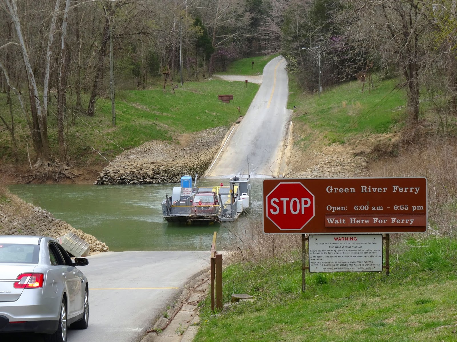

Soon we reached the mouth of the River Styx where there used to be an old riverboat landing. As the river was replaced as a means of transporting large loads by the railroad, steamboats took over touring the Green River, offering cruises complete with musicians, fine dining, traveling shows and circuses. We turned inland on the 0.4 mile River Styx boardwalk which leads to the point where the River Styx emerges above-ground for a short trip to empty into the Green River.


A short climb on the Echo River Spring trail brought us to the 0.3 mile Sunset Point trail which took us up the steep bluffs through a series of switchbacks. It was here that the boys encountered their third deer, eliciting a few screams as it crashed across the trail just as they had rounded a corner out of our line of sight – affecting a few more gray hairs before we learned the reason for their shrieks.


Sunset Point might provide a scenic viewpoint of the sun setting over the river; however it was more convenient as a rest point after a steep climb even as the shadows lengthened. The boys used the opportunity to continue work on their Junior Ranger Adventure books, the effort rewarded the following day when they received their hard-earned badges at the Visitor Center.


From Sunset Point we followed the half-mile paved Heritage loop past the Mammoth Cave Hotel back to the Visitor Center. Our loop totaled about 1.5 miles, but as it included several steep portions it was a challenging, rewarding hike. By including the entire Green River Bluffs trail it could easily be extended to 2 miles, and by adding loops to Dome Sink, Echo River and White Cave one could easily incorporate 4-5 miles of trail into their itinerary.

The view from Sunset Point


It seemed easy to separate our visit to Mammoth Cave into two parts; the descent into the underground world of the cave system, and the above-ground realm of rivers, forests and wildflowers. However, in reality these are two parts of a greater whole (hole!), unified by the various forces of nature that continue to form the caves and shape the landscape of this one ecosystem linked by water. With a wide variety of tours, trails and adventures awaiting, Mammoth Cave National Park is deserving of the title of World Heritage Site and should be included on your quest to find your park.

Friday, April 8, 2016

Guntis does Greenville

The world-renowned Baltic languages professor was in South Carolina for a conference, and was able to sneak in some time with us. In addition to the usual tour of downtown that we offer guests, he also got to take a special trip out to Furman University with the boys.

The Furman clock tower
Dr. Charles Townes statue, downtown Greenville
The famous Falls Park beech tree

Chihuly, Falls Park

Spring in Falls Park

Max Heller, downtown Greenville

Liberty Bridge, Falls Park on the Reedy River

Taking a break in M Judson bookstore

Searching for the Mice on Main

Falls Park on the Reedy River


See what all you can do in a couple days’ time? Currently accepting reservations for the months of April and May…

Gen. Nathanael Greene, downtown Greenville

Related Posts Plugin for WordPress, Blogger...